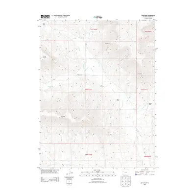
2013 Map of Long Point
USGS Topo · Published 2013About this map
Roan Creek serves as the primary drainage through this corner of Garfield County, defining a landscape of high ridges and intricate irrigation networks. The map details a complex system of water management essential to the high desert, including the HVS and S Ditch, Hobo Ditch, and the Cr and Newman Ditch, which redirect water along the valley floors. High points such as Kimball Mountain and the prominent Chimney Rock overlook several deep gulches, including Hopple Gulch and Gibler Gulch. This 2013 survey provides a clear view of the ranching and resource infrastructure in the region, tracing the intersection of Kimball Creek and Dry Fork Roan Creek against the steep backdrop of Cow Ridge.
Find a feature on this map
29 named features on this map. Tap any name to fly to it.
Don’t see what you’re looking for? This feature index may not catch every label — zoom into the map to look around manually.
Map Details
Editions of this 2013 Long Point Map
This is the sole edition of this map. No revisions or reprints were ever made.
Other maps of this area

1925 · Parachute Creek
USGS Topo · 1:62,500

1927 · Parachute Creek
USGS Topo · 1:62,500

1929 · Grand Valley
USGS Topo · 1:62,500

1929 · Highmore
USGS Topo · 1:62,500

1929 · Roan Creek
USGS Topo · 1:62,500

1956 · Grand Junction
USGS Topo · 1:250,000

1959 · Grand Junction
USGS Topo · 1:250,000

1960 · Grand Junction
USGS Topo · 1:250,000

1962 · Grand Junction
USGS Topo · 1:250,000
1962 · Red Pinnacle
USGS Topo · 1:24,000