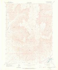
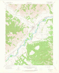
1962 Map of Red Pinnacle
USGS Topo · Published 1964About this map
Mount Logan and Red Pinnacle dominate this high-desert terrain of Garfield County, where deep canyons and drainage systems define the landscape. This early 1960s survey records a network of gulches including Gilman Gulch, Bowdish Gulch, and Riley Gulch, illustrating the complex watershed feeding into the Colorado River at the sheet's southern edge. In the lowlands near the river, human intervention is visible through the Bluestone Valley Ditch and the tracks of the Denver and Rio Grande Western railroad. Higher elevations are marked by isolated Cabins and water sources like Hayward Spring and Pritchard Spring. The presence of the Bowdish Trail and Tourist Run suggests established routes through the steep topography, while labels like Shale point to the geological composition and potential industrial interest of the region during this era.
Find a feature on this map
25 named features on this map. Tap any name to fly to it.
Don’t see what you’re looking for? This feature index may not catch every label — zoom into the map to look around manually.
Map Details
Editions of this 1962 Red Pinnacle Map
4 editions found
Other maps of this area

1925 · Parachute Creek
USGS Topo · 1:62,500

1927 · Parachute Creek
USGS Topo · 1:62,500

1929 · Grand Valley
USGS Topo · 1:62,500

1929 · Highmore
USGS Topo · 1:62,500

1929 · Roan Creek
USGS Topo · 1:62,500

1956 · Grand Junction
USGS Topo · 1:250,000

1959 · Grand Junction
USGS Topo · 1:250,000

1960 · Grand Junction
USGS Topo · 1:250,000

1962 · Grand Junction
USGS Topo · 1:250,000
1962 · Grand Valley
USGS Topo · 1:24,000