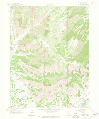
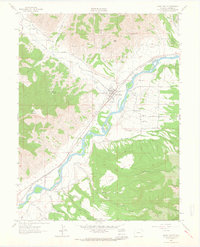
1962 Map of Red Pinnacle
USGS Topo · Published 1964About this map
Red Pinnacle and Mount Logan anchor this high-altitude landscape in Garfield County, where the terrain falls away into deep drainage systems like Logan Wash and Bowdish Gulch. The 1962 field check captures the area's transition from the high plateau down to the Colorado River valley. Water management and resource extraction are central themes, evidenced by the presence of Shale deposits and the engineered Bluestone Valley Ditch.
Find a feature on this map
28 named features on this map. Tap any name to fly to it.
Don’t see what you’re looking for? This feature index may not catch every label — zoom into the map to look around manually.
Map Details
Editions of this 1962 Red Pinnacle Map
4 editions found
Other maps of this area

1925 · Parachute Creek
USGS Topo · 1:62,500

1927 · Parachute Creek
USGS Topo · 1:62,500

1929 · Grand Valley
USGS Topo · 1:62,500

1929 · Highmore
USGS Topo · 1:62,500

1929 · Roan Creek
USGS Topo · 1:62,500

1956 · Grand Junction
USGS Topo · 1:250,000

1959 · Grand Junction
USGS Topo · 1:250,000

1960 · Grand Junction
USGS Topo · 1:250,000

1962 · Grand Junction
USGS Topo · 1:250,000
1962 · Grand Valley
USGS Topo · 1:24,000