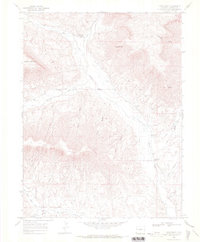
1968 Map of Long Point
USGS Topo · Published 1972About this map
Roan Creek Community Center serves as a central landmark in this high-desert landscape of western Colorado, where deep gulches and high ridges dictate the pattern of settlement. This 1968 survey reveals a rural society built around water management and education, with the Kimball Creek School, Conn Creek Sch, and Dry Fork Sch distributed along the major drainages to serve ranching families. The complex network of irrigation, including the Hobo Ditch and Gibler Ditch, illustrates the intensive effort required to move water from Roan Creek and Clear Creek to the valley floors.
Find a feature on this map
41 named features on this map. Tap any name to fly to it.
Don’t see what you’re looking for? This feature index may not catch every label — zoom into the map to look around manually.
Map Details
Editions of this 1968 Long Point Map
This is the sole edition of this map. No revisions or reprints were ever made.
Other maps of this area

1925 · Parachute Creek
USGS Topo · 1:62,500

1927 · Parachute Creek
USGS Topo · 1:62,500

1929 · Grand Valley
USGS Topo · 1:62,500

1929 · Highmore
USGS Topo · 1:62,500

1929 · Roan Creek
USGS Topo · 1:62,500

1956 · Grand Junction
USGS Topo · 1:250,000

1959 · Grand Junction
USGS Topo · 1:250,000

1960 · Grand Junction
USGS Topo · 1:250,000

1962 · Grand Junction
USGS Topo · 1:250,000
1962 · Red Pinnacle
USGS Topo · 1:24,000