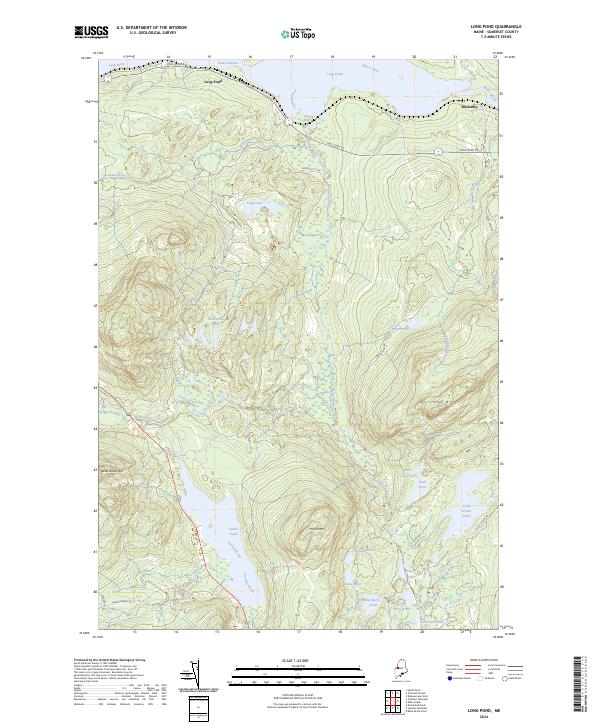
2024 Map of Long Pond
USGS Topo · Published 2024About this map
Parlin Pond and the surrounding peaks of the Boundary Mountains dominate this Somerset County landscape, where the waters of Piel Brook and Twomile Brook converge. The topography is defined by significant elevations such as Parlin Mtn and Williams Mtn, while the northern edge of the map follows the course of the Moose River through the Lower Narrows into Long Pond. Small, isolated water bodies including Fernald Pond, Snake Pond, and Durgin Pond are scattered throughout the interior, connected by a network of drainage systems like Parlin Stream and Lang Stream. The settlement at Mackamp stands as a focal point in the northeast, positioned where Maccamp Rd meets the river. This 2024 survey captures the area's transition into a managed woodland, marked by numerous logging and access routes such as Old Route 15 Rd and Long Pond Rd.
Find a feature on this map
35 named features on this map. Tap any name to fly to it.
Don’t see what you’re looking for? This feature index may not catch every label — zoom into the map to look around manually.
Map Details
Editions of this 2024 Long Pond Map
This is the sole edition of this map. No revisions or reprints were ever made.
Other maps of this area

1905 · The Forks
USGS Topo · 1:62,500

1907 · The Forks
USGS Topo · 1:62,500

1921 · Brassua Lake
USGS Topo · 1:62,500

1922 · Long Pond
USGS Topo · 1:62,500

1923 · Brassua Lake
USGS Topo · 1:62,500

1924 · Long Pond
USGS Topo · 1:62,500

1925 · Pierce Pond
USGS Topo · 1:48,000

1927 · Pierce Pond
USGS Topo · 1:62,500

1944 · Brassua Lake
USGS Topo · 1:62,500

1944 · Long Pond
USGS Topo · 1:62,500