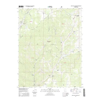
2017 Map of Long Valley Junction
USGS Topo · Published 2017About this map
Long Valley Junction serves as the focal point of this southwestern Utah survey, where the convergence of major travel routes meets the headwaters of the E Fork Virgin River. The landscape transitions from the high elevations of the Markagunt Plateau down through the dramatic Pink Cliffs toward the settlements of Alton and Glendale. Within the Dixie National Forest, the map reveals a network of recreational and access loops, including the Turkey Track Loop and Harris Rim Loop, alongside specialized sites like the Swains Creek Airport. Evidence of the area's hydraulic history is visible in the distribution of named water sources such as Gravel Spring, Jolly Spring, and Houdy Spring, which supported the livestock and small-scale agriculture found in Harris Flat and Long Valley. The terrain is deeply incised by numerous canyons, including Johnson Canyon and Shingle Mill Canyon, which follow the natural drainage patterns toward the river valley below.
Find a feature on this map
64 named features on this map. Tap any name to fly to it.
Don’t see what you’re looking for? This feature index may not catch every label — zoom into the map to look around manually.
Map Details
Editions of this 2017 Long Valley Junction Map
This is the sole edition of this map. No revisions or reprints were ever made.
Other maps of this area

1886 · Kanab
USGS Topo · 1:250,000

1953 · Cedar City
USGS Topo · 1:250,000

1958 · Cedar City
USGS Topo · 1:250,000

1958 · Orderville
USGS Topo · 1:62,500

1958 · Panguitch Lake
USGS Topo · 1:62,500

1962 · Cedar City
USGS Topo · 1:250,000

1966 · Alton
USGS Topo · 1:24,000

1966 · Bald Knoll
USGS Topo · 1:24,000

1966 · George Mtn
USGS Topo · 1:24,000

1980 · Panguitch
USGS Topo · 1:100,000