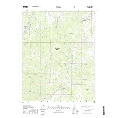
2020 Map of Long Valley Junction
USGS Topo · Published 2020About this map
Dixie National Forest covers the high-elevation terrain of the Markagunt Plateau, where the geography is defined by a dense network of drainages and dramatic geological features like the Pink Cliffs. The settlement pattern is concentrated in the east along the corridor of the E Fork Virgin River, which flows through Long Valley and supports the small communities of Glendale and Long Valley Junction.
Find a feature on this map
54 named features on this map. Tap any name to fly to it.
Don’t see what you’re looking for? This feature index may not catch every label — zoom into the map to look around manually.
Map Details
Editions of this 2020 Long Valley Junction Map
This is the sole edition of this map. No revisions or reprints were ever made.
Other maps of this area

1886 · Kanab
USGS Topo · 1:250,000

1953 · Cedar City
USGS Topo · 1:250,000

1958 · Cedar City
USGS Topo · 1:250,000

1958 · Orderville
USGS Topo · 1:62,500

1958 · Panguitch Lake
USGS Topo · 1:62,500

1962 · Cedar City
USGS Topo · 1:250,000

1966 · Alton
USGS Topo · 1:24,000

1966 · Bald Knoll
USGS Topo · 1:24,000

1966 · George Mtn
USGS Topo · 1:24,000

1980 · Panguitch
USGS Topo · 1:100,000