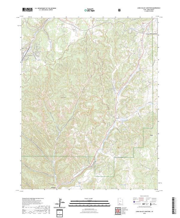
2023 Map of Long Valley Junction
USGS Topo · Published 2023About this map
The Markagunt Plateau defines the northern reaches of this Kane County region, where the high-altitude terrain gives way to the striking Pink Cliffs and deep incisions of Dairy Canyon. This area of southern Utah is characterized by the headwaters of the East Fork Virgin River, which winds through the central Long Valley. The map details the intersection of high-country ranching and remote transport hubs, centered on Long Valley Junction.
Find a feature on this map
59 named features on this map. Tap any name to fly to it.
Don’t see what you’re looking for? This feature index may not catch every label — zoom into the map to look around manually.
Map Details
Editions of this 2023 Long Valley Junction Map
This is the sole edition of this map. No revisions or reprints were ever made.
Other maps of this area

1886 · Kanab
USGS Topo · 1:250,000

1953 · Cedar City
USGS Topo · 1:250,000

1958 · Cedar City
USGS Topo · 1:250,000

1958 · Orderville
USGS Topo · 1:62,500

1958 · Panguitch Lake
USGS Topo · 1:62,500

1962 · Cedar City
USGS Topo · 1:250,000

1966 · Alton
USGS Topo · 1:24,000

1966 · Bald Knoll
USGS Topo · 1:24,000

1966 · George Mtn
USGS Topo · 1:24,000

1980 · Panguitch
USGS Topo · 1:100,000