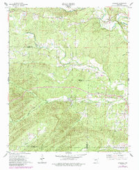
1972 Map of Lonsdale
USGS Topo · Published 1984About this map
Lonsdale and the surrounding borderlands of Garland and Saline counties are defined by the convergence of the Saline River's many forks. This 1970s landscape, later updated in the early 1980s, reveals a rural network of small communities and dispersed landmarks. In the north, Owensville and Crows sit near the Middle Fork Saline River, while the southern reaches are marked by the South Fork Saline River and the winding Tigre Creek.
Find a feature on this map
26 named features on this map. Tap any name to fly to it.
Don’t see what you’re looking for? This feature index may not catch every label — zoom into the map to look around manually.
Map Details
Editions of this 1972 Lonsdale Map
4 editions found
Other maps of this area

1890 · Benton
USGS Topo · 1:125,000

1894 · Benton
USGS Topo · 1:125,000

1938 · Benton
USGS Topo · 1:48,000

1944 · Benton
USGS Topo · 1:62,500

1948 · Malvern
USGS Topo · 1:62,500

1949 · Malvern
USGS Topo · 1:62,500

1955 · Little Rock
USGS Topo · 1:250,000

1956 · Little Rock
USGS Topo · 1:250,000

1960 · Little Rock
USGS Topo · 1:250,000

1963 · Traskwood
USGS Topo · 1:24,000