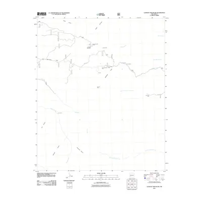
2011 Map of Lookout Mountain
USGS Topo · Published 2011About this map
Silver Monument Mine and several other historic extraction sites define this high-altitude landscape in the Gila National Forest area. The map documents a cluster of mining activity including the Silver Glance Mine, Silver Bar Mine, and Tomahawk Mine, all situated near the headwaters of Chloride Creek. This concentration of lode claims and workings suggests a significant silver-bearing district carved into the rugged drainages of Blackhawk Gulch.
Find a feature on this map
45 named features on this map. Tap any name to fly to it.
Don’t see what you’re looking for? This feature index may not catch every label — zoom into the map to look around manually.
Map Details
Editions of this 2011 Lookout Mountain Map
This is the sole edition of this map. No revisions or reprints were ever made.
Other maps of this area

1949 · Lookout Mountain
USGS Topo · 1:62,500

1954 · Tularosa
USGS Topo · 1:250,000

1958 · Tularosa
USGS Topo · 1:250,000

1963 · Bonner Canyon
USGS Topo · 1:24,000

1963 · Reeds Peak
USGS Topo · 1:24,000

1963 · Sugarloaf Peak
USGS Topo · 1:24,000

1965 · Winston
USGS Topo · 1:24,000

1965 · Iron Mountain
USGS Topo · 1:24,000

1979 · Truth or Consequences
USGS Topo · 1:100,000
1981 · Taylor Peak
USGS Topo · 1:24,000