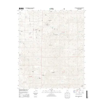
2013 Map of Lookout Mountain
USGS Topo · Published 2013About this map
The Continental Divide traces a high-altitude path through this portion of the Black Range, where the geography is defined by a dense network of canyons and gulches. Located within the Gila National Forest, the terrain rises toward Lookout Mtn, which is topped by the Lookout Mountain Lookout. This 2013 survey shows a landscape where water sources like James Brothers Spring and Sawmill Cabin Spring are critical markers in an otherwise arid environment.
Find a feature on this map
40 named features on this map. Tap any name to fly to it.
Don’t see what you’re looking for? This feature index may not catch every label — zoom into the map to look around manually.
Map Details
Editions of this 2013 Lookout Mountain Map
This is the sole edition of this map. No revisions or reprints were ever made.
Other maps of this area

1949 · Lookout Mountain
USGS Topo · 1:62,500

1954 · Tularosa
USGS Topo · 1:250,000

1958 · Tularosa
USGS Topo · 1:250,000

1963 · Bonner Canyon
USGS Topo · 1:24,000

1963 · Reeds Peak
USGS Topo · 1:24,000

1963 · Sugarloaf Peak
USGS Topo · 1:24,000

1965 · Winston
USGS Topo · 1:24,000

1965 · Iron Mountain
USGS Topo · 1:24,000

1979 · Truth or Consequences
USGS Topo · 1:100,000
1981 · Taylor Peak
USGS Topo · 1:24,000