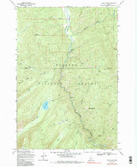
1969 Map of Loon Lake
USGS Topo · Published 1985About this map
Secesh Meadows and the surrounding wilderness of the Payette National Forest dominate this mid-century survey of the Idaho backcountry. The landscape is defined by the winding course of the Secesh River and its numerous tributaries, including the curiously named Whangdoodle Creek and Jungle Creek. This era of the forest is captured through its network of primitive transportation, with the Secesh Trail and various pack trails serving as the primary arteries through the timbered drainages.
Find a feature on this map
22 named features on this map. Tap any name to fly to it.
Don’t see what you’re looking for? This feature index may not catch every label — zoom into the map to look around manually.
Map Details
Editions of this 1969 Loon Lake Map
2 editions found
Other maps of this area

1956 · Burgdorf
USGS Topo · 1:62,500

1956 · Warren
USGS Topo · 1:62,500

1956 · Elk City
USGS Topo · 1:250,000

1960 · Elk City
USGS Topo · 1:250,000

1969 · Loon Lake
USGS Topo · 1:24,000

1969 · Pony Meadows
USGS Topo · 1:24,000

1969 · Enos Lake
USGS Topo · 1:24,000
1969 · Box Lake
USGS Topo · 1:24,000

1969 · Williams Peak
USGS Topo · 1:24,000
1969 · Victor Peak
USGS Topo · 1:24,000