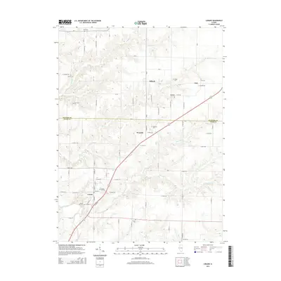
2015 Map of Loraine
USGS Topo · Published 2015About this map
The borderlands of Hancock and Adams counties in Illinois are defined by a network of small agricultural settlements and family burial grounds in this 2015 study. The village of Loraine serves as a local hub near the southern edge, situated near the headwaters of South Fork Bear Creek. To the north, the smaller communities of Stillwell, Woodville, and Chili are connected by a grid of numbered roads and county routes. The landscape is deeply etched by the drainage of Panther Cr and Thurman Cr, creating a complex topography that contrasts with the surrounding agricultural tablelands. Genealogists will find this particular survey exceptionally valuable for its identification of small, often overlooked burial sites such as the Bean Family Cem, Breneman Farm Cem, and the Curless Cem, preserving the legacy of the region's early farming families within the modern rural landscape.
Find a feature on this map
69 named features on this map. Tap any name to fly to it.
Don’t see what you’re looking for? This feature index may not catch every label — zoom into the map to look around manually.
Map Details
Editions of this 2015 Loraine Map
This is the sole edition of this map. No revisions or reprints were ever made.
Other maps of this area

1933 · Carthage
USGS Topo · 1:62,500

1936 · Keokuk
USGS Topo · 1:62,500

1937 · Carthage
USGS Topo · 1:62,500

1946 · Mendon
USGS Topo · 1:62,500

1948 · Mendon
USGS Topo · 1:62,500

1948 · Camp Point
USGS Topo · 1:62,500

1950 · Keokuk
USGS Topo · 1:62,500

1958 · Burlington
USGS Topo · 1:250,000

1961 · Burlington
USGS Topo · 1:250,000

1963 · Burlington
USGS Topo · 1:250,000