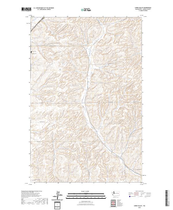
2023 Map of Lords Valley
USGS Topo · Published 2023About this map
Lords Valley serves as the central geographic feature of this Lincoln County landscape, defining the drainage patterns for Lords Creek as it winds through the township sections. The land is marked by a network of rural routes named for local families and landmarks, such as Talkington Rd, Platter Rd N, and Armstrong Rd. On the western edge of the quadrangle, Hillcrest Cem and Saint Francis Cem stand near the junction of Harrington Airport Rd and S Coal Creek Rd, providing vital points of interest for genealogists and local historians. This contemporary USGS survey reflects the enduring agricultural layout of the region, where roads like Mohler Rd E and Gilliland Rd follow the rigid grid of established land boundaries while navigating the natural contours of the northern Washington terrain.
Find a feature on this map
25 named features on this map. Tap any name to fly to it.
Don’t see what you’re looking for? This feature index may not catch every label — zoom into the map to look around manually.
Map Details
Editions of this 2023 Lords Valley Map
This is the sole edition of this map. No revisions or reprints were ever made.
Other maps of this area

1953 · Ritzville
USGS Topo · 1:250,000

1959 · Ritzville
USGS Topo · 1:250,000

1965 · Ritzville
USGS Topo · 1:250,000

1969 · Bluestem
USGS Topo · 1:24,000

1969 · Harrington
USGS Topo · 1:24,000

1969 · Sprague Lake
USGS Topo · 1:24,000

1969 · Lords Valley
USGS Topo · 1:24,000

1969 · Omans
USGS Topo · 1:24,000
1969 · Sprague Lake SW
USGS Topo · 1:24,000
1969 · Rocklyn SE
USGS Topo · 1:24,000