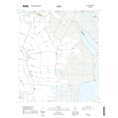
2018 Map of Loreauville
USGS Topo · Published 2018About this map
Loreauville sits at the heart of this landscape, where the agricultural flats of Iberia Parish meet the complex hydrology of the Atchafalaya Basin. The map illustrates a transitional geography defined by the winding course of Bayou Teche in the west and the expansive Atchafalaya Basin Floodway to the east. Linear settlements and road networks, such as those at Bronson, Oubre, and Mestayer, follow the natural levees and drainage patterns common to this part of Acadiana.
Find a feature on this map
83 named features on this map. Tap any name to fly to it.
Don’t see what you’re looking for? This feature index may not catch every label — zoom into the map to look around manually.
Map Details
Editions of this 2018 Loreauville Map
This is the sole edition of this map. No revisions or reprints were ever made.
Other maps of this area

1937 · Jeanerette
USGS Topo · 1:62,500

1937 · Derouen
USGS Topo · 1:62,500

1939 · St. Martinsville
USGS Topo · 1:62,500

1941 · Loreauville
USGS Topo · 1:62,500

1945 · New Orleans
USGS Topo · 1:250,000

1954 · Loreauville
USGS Topo · 1:62,500

1954 · Jeanerette
USGS Topo · 1:62,500

1954 · Baton Rouge
USGS Topo · 1:250,000

1956 · Baton Rouge
USGS Topo · 1:250,000

1957 · St. Martinville
USGS Topo · 1:62,500