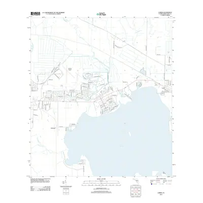
2012 Map of Lorida
USGS Topo · Published 2012About this map
Lake Istokpoga dominates the southern half of this landscape, its expansive shoreline defining the local geography and settlement patterns in Highlands County. The community of Lorida is situated along the northeastern edge of the water, while the smaller settlement of Istokpoga lies to the west. This 2012 survey illustrates the residential development hugging the lake's northern rim, characterized by a network of drives and terraces like Rock Creek Ter and Lakeside Way. Inland, the terrain is shaped by watercourses such as Arbuckle Cr and Yellow Bluff Cr. The presence of Sebring Regional Airport in the northwest corner highlights the area's role as a regional transportation hub, contrasting with the quiet residential and natural areas surrounding Big Island in the south.
Find a feature on this map
94 named features on this map. Tap any name to fly to it.
Don’t see what you’re looking for? This feature index may not catch every label — zoom into the map to look around manually.
Map Details
Editions of this 2012 Lorida Map
This is the sole edition of this map. No revisions or reprints were ever made.
Other maps of this area

1952 · Fort Kissimmee
USGS Topo · 1:24,000

1952 · Lake Placid
USGS Topo · 1:24,000

1952 · Lake Arbuckle SW
USGS Topo · 1:24,000

1952 · Lake Arbuckle SE
USGS Topo · 1:24,000

1952 · Lorida
USGS Topo · 1:24,000

1952 · Sebring
USGS Topo · 1:24,000

1953 · Lake June In Winter
USGS Topo · 1:24,000

1953 · Basinger SW
USGS Topo · 1:24,000

1953 · Basinger NW
USGS Topo · 1:24,000

1956 · Fort Pierce
USGS Topo · 1:250,000