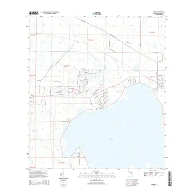
2015 Map of Lorida
USGS Topo · Published 2015About this map
Lake Istokpoga dominates the southern landscape of this Highlands County region, where the marshy northern shoreline meets a complex network of drainage and creek systems. The settlement of Lorida sits near the northeastern edge of the lake, serving as a focal point for the surrounding rural and residential development. To the northwest, the extensive infrastructure of the Sebring Regional Airport marks a transition from the agricultural and natural wetlands to more industrial usage. The map documents the intricate hydrology of the area, defined by the winding paths of Arbuckle Cr and Arbuckle Br as they feed into the lake. These watercourses, alongside Josephine Cr and Yellow Bluff Cr, illustrate the low-lying, water-dependent character of the Florida interior before it reaches the larger landmass of Big Island in the southeast.
Find a feature on this map
90 named features on this map. Tap any name to fly to it.
Don’t see what you’re looking for? This feature index may not catch every label — zoom into the map to look around manually.
Map Details
Editions of this 2015 Lorida Map
This is the sole edition of this map. No revisions or reprints were ever made.
Other maps of this area

1952 · Fort Kissimmee
USGS Topo · 1:24,000

1952 · Lake Placid
USGS Topo · 1:24,000

1952 · Lake Arbuckle SW
USGS Topo · 1:24,000

1952 · Lake Arbuckle SE
USGS Topo · 1:24,000

1952 · Lorida
USGS Topo · 1:24,000

1952 · Sebring
USGS Topo · 1:24,000

1953 · Lake June In Winter
USGS Topo · 1:24,000

1953 · Basinger SW
USGS Topo · 1:24,000

1953 · Basinger NW
USGS Topo · 1:24,000

1956 · Fort Pierce
USGS Topo · 1:250,000