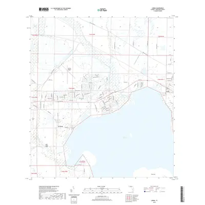
2018 Map of Lorida
USGS Topo · Published 2018About this map
Lake Istokpoga dominates the southern landscape of this 2018 Highlands County survey, its northern waters reaching toward the settlements of Istokpoga and Lorida. The map details a complex transition between the expansive aquatic environment of the lake and the agricultural and residential development to the north. Significant landmarks such as the Sebring Regional Airport and the distinct topographic rise of the Lake Wales Ridge provide context for the local economy and geography.
Find a feature on this map
95 named features on this map. Tap any name to fly to it.
Don’t see what you’re looking for? This feature index may not catch every label — zoom into the map to look around manually.
Map Details
Editions of this 2018 Lorida Map
This is the sole edition of this map. No revisions or reprints were ever made.
Other maps of this area

1952 · Fort Kissimmee
USGS Topo · 1:24,000

1952 · Lake Placid
USGS Topo · 1:24,000

1952 · Lake Arbuckle SW
USGS Topo · 1:24,000

1952 · Lake Arbuckle SE
USGS Topo · 1:24,000

1952 · Lorida
USGS Topo · 1:24,000

1952 · Sebring
USGS Topo · 1:24,000

1953 · Lake June In Winter
USGS Topo · 1:24,000

1953 · Basinger SW
USGS Topo · 1:24,000

1953 · Basinger NW
USGS Topo · 1:24,000

1956 · Fort Pierce
USGS Topo · 1:250,000