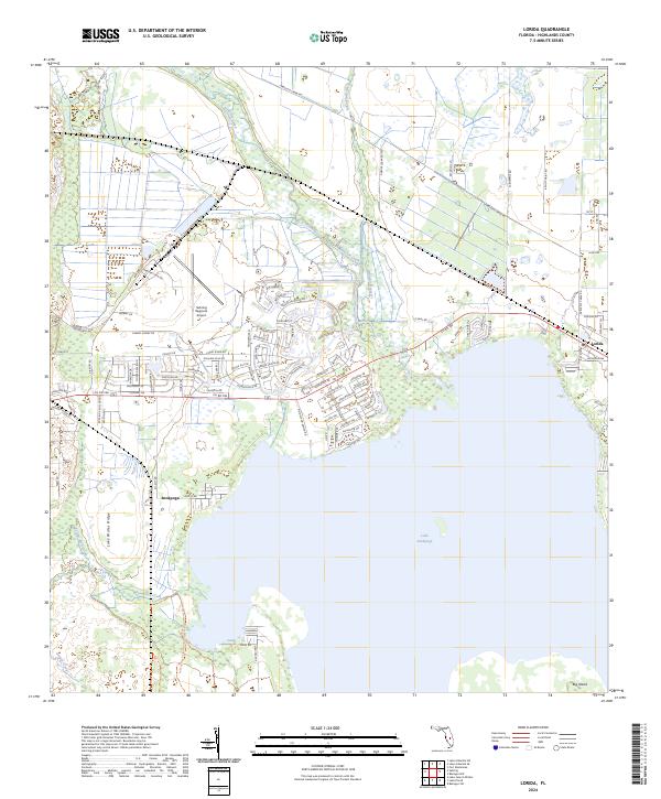
2024 Map of Lorida
USGS Topo · Published 2024About this map
Lake Istokpoga dominates the southern landscape of this Highlands County region, its northern shoreline defined by a network of drainage and residential development. The small settlement of Lorida sits near the northeastern edge of the lake, serving as a focal point for the surrounding rural and agricultural lands. North of the lake, the Sebring Regional Airport occupies a significant portion of the interior, illustrating the area's transition from wetlands to aviation and industrial use.
Find a feature on this map
105 named features on this map. Tap any name to fly to it.
Don’t see what you’re looking for? This feature index may not catch every label — zoom into the map to look around manually.
Map Details
Editions of this 2024 Lorida Map
This is the sole edition of this map. No revisions or reprints were ever made.
Other maps of this area

1952 · Fort Kissimmee
USGS Topo · 1:24,000

1952 · Lake Placid
USGS Topo · 1:24,000

1952 · Lake Arbuckle SW
USGS Topo · 1:24,000

1952 · Lake Arbuckle SE
USGS Topo · 1:24,000

1952 · Lorida
USGS Topo · 1:24,000

1952 · Sebring
USGS Topo · 1:24,000

1953 · Lake June In Winter
USGS Topo · 1:24,000

1953 · Basinger SW
USGS Topo · 1:24,000

1953 · Basinger NW
USGS Topo · 1:24,000

1956 · Fort Pierce
USGS Topo · 1:250,000