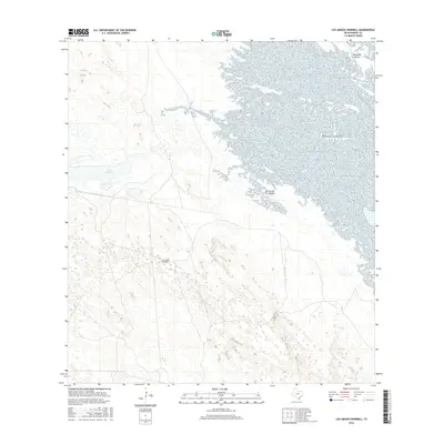
2016 Map of Los Amigos Windmill
USGS Topo · Published 2016About this map
Cayo Soledad and the expansive wetlands of Rincon de la Soledad dominate this landscape in eastern Kenedy County. The coastal terrain is defined by a complex network of marshes and inlets leading toward the Gulf of Mexico, illustrating the delicate transition between the South Texas brush country and the coastal prairies. Named landmarks such as the Los Amigos Windmill indicate the historical importance of water management in this sparsely populated ranching region. To the north, the elevation shifts slightly at Mesquite Rincon, where E Turcotte Rd provides a primary point of access through the otherwise trackless terrain. This 2016 survey documents the modern hydrology of a region where geography is dictated by tide and seasonal water flow.
Find a feature on this map
6 named features on this map. Tap any name to fly to it.
Don’t see what you’re looking for? This feature index may not catch every label — zoom into the map to look around manually.
Map Details
Editions of this 2016 Los Amigos Windmill Map
This is the sole edition of this map. No revisions or reprints were ever made.
Other maps of this area

1921 · Tarida Ranch
USGS Topo · 1:62,500

1923 · Lopena Island
USGS Topo · 1:62,500

1923 · Saltillo Ranch
USGS Topo · 1:62,500

1951 · Potrero Lopeno NW
USGS Topo · 1:24,000

1952 · South of Potrero Lopeno NW
USGS Topo · 1:24,000

1952 · Potrero Lopeno SW
USGS Topo · 1:24,000

1952 · Potrero Lopeno
USGS Topo · 1:62,500

1952 · South of Potrero Lopeno
USGS Topo · 1:62,500

1953 · Brownsville
USGS Topo · 1:250,000
1956 · San Pedro Ranch
USGS Topo · 1:24,000