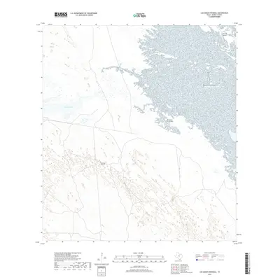
2019 Map of Los Amigos Windmill
USGS Topo · Published 2019About this map
Cayo Soledad cuts through a landscape defined by expansive wetlands and coastal formations along the South Texas gulf region. This 2019 survey captures the area's transition from the western ranchlands toward the shoreline, where the Rincon de la Soledad meets a complex network of coastal inlets. The terrain is notably sparse, reflecting the massive private holdings typical of Kenedy County, where geography is marked by isolated features like the Los Amigos Windmill.
Find a feature on this map
5 named features on this map. Tap any name to fly to it.
Don’t see what you’re looking for? This feature index may not catch every label — zoom into the map to look around manually.
Map Details
Editions of this 2019 Los Amigos Windmill Map
This is the sole edition of this map. No revisions or reprints were ever made.
Other maps of this area

1921 · Tarida Ranch
USGS Topo · 1:62,500

1923 · Lopena Island
USGS Topo · 1:62,500

1923 · Saltillo Ranch
USGS Topo · 1:62,500

1951 · Potrero Lopeno NW
USGS Topo · 1:24,000

1952 · South of Potrero Lopeno NW
USGS Topo · 1:24,000

1952 · Potrero Lopeno SW
USGS Topo · 1:24,000

1952 · Potrero Lopeno
USGS Topo · 1:62,500

1952 · South of Potrero Lopeno
USGS Topo · 1:62,500

1953 · Brownsville
USGS Topo · 1:250,000
1956 · San Pedro Ranch
USGS Topo · 1:24,000