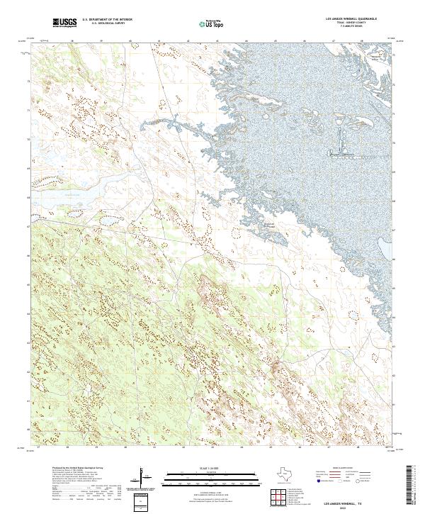
2022 Map of Los Amigos Windmill
USGS Topo · Published 2022About this map
Coastal wetlands and low-lying rincóns characterize this remote stretch of the South Texas landscape. The prominent Cayo Soledad waterway dominates the western portion of the terrain, weaving through a complex network of marshes and ephemeral pools typical of the Kenedy County coastline. On the eastern side, the map documents distinct topographical rises known locally as rincóns, including Rincon de la Soledad and Mesquite Rincon, which provide slightly elevated ground amidst the surrounding wetlands. Human imprint is minimal, represented largely by the path of E Turcotte Rd in the northeastern corner. This U.S. Geological Survey representation emphasizes the natural hydrography and the unique coastal geography of the Wild Horse Desert region.
Find a feature on this map
4 named features on this map. Tap any name to fly to it.
Don’t see what you’re looking for? This feature index may not catch every label — zoom into the map to look around manually.
Map Details
Editions of this 2022 Los Amigos Windmill Map
This is the sole edition of this map. No revisions or reprints were ever made.
Other maps of this area

1921 · Tarida Ranch
USGS Topo · 1:62,500

1923 · Lopena Island
USGS Topo · 1:62,500

1923 · Saltillo Ranch
USGS Topo · 1:62,500

1951 · Potrero Lopeno NW
USGS Topo · 1:24,000

1952 · South of Potrero Lopeno NW
USGS Topo · 1:24,000

1952 · Potrero Lopeno SW
USGS Topo · 1:24,000

1952 · Potrero Lopeno
USGS Topo · 1:62,500

1952 · South of Potrero Lopeno
USGS Topo · 1:62,500

1953 · Brownsville
USGS Topo · 1:250,000
1956 · San Pedro Ranch
USGS Topo · 1:24,000