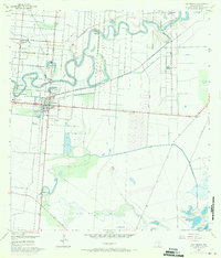
1955 Map of Los Fresnos
USGS Topo · Published 1971About this map
The Palo Alto Battlefield anchors the southern portion of this landscape, marked by a Historical Monument commemorating the 1846 conflict. By the mid-20th century, the area had transformed into an intricate network of irrigation ditches and resacas, with the winding Resaca de los Cuates cutting through the center. The settlement of Los Fresnos serves as the primary hub, where the Southern Pacific railroad line intersects with local infrastructure like the Filtration Plant and the Los Fresnos Sch. To the north and west, smaller communities and agricultural outposts such as Laureles, La Peñusca, and Wardner Ranch illustrate the rural development of Cameron County. The presence of the Tule Lake Bed and numerous named water features like Agua Negra and Charco Hondo reveal a complex drainage system essential to the regional farm economy of the era.
Find a feature on this map
30 named features on this map. Tap any name to fly to it.
Don’t see what you’re looking for? This feature index may not catch every label — zoom into the map to look around manually.
Map Details
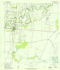
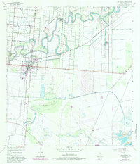
Editions of this 1955 Los Fresnos Map
3 editions found
Other maps of this area

1929 · Rio Hondo
USGS Topo · 1:24,000

1929 · La Coma
USGS Topo · 1:24,000

1929 · Palmito Hill
USGS Topo · 1:24,000

1929 · Laguna Vista
USGS Topo · 1:24,000

1930 · Los Fresnos
USGS Topo · 1:24,000

1930 · West Brownsville
USGS Topo · 1:24,000

1930 · Barreda
USGS Topo · 1:24,000

1930 · Laguna Atascosa
USGS Topo · 1:24,000

1930 · East Brownsville
USGS Topo · 1:24,000

1932 · Rio Hondo
USGS Topo · 1:31,680