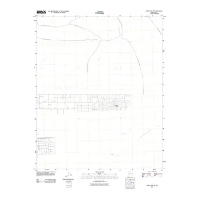
2010 Map of Los Lunas SE
USGS Topo · Published 2010About this map
Meadow Lake serves as a primary residential hub in this high-desert landscape of Valencia County. The settlement pattern is defined by a rigorous grid of residential streets, notably bounded by High Mesa Rd and the Cordero Loop. This structured development contrasts sharply with the expansive arid terrain surrounding it, which is traversed by a network of Bureau of Indian Affairs routes including Indian Service Route 625 and Indian Service Route 603. These thoroughfares suggest a landscape managed for access across open rangeland and tribal territories. Water sources are critical markers in this environment, indicated by Maes Spring and Carrizo Spring, which provide natural points of interest away from the developed roads like San Francisco Ave and San Antonio Rd.
Find a feature on this map
13 named features on this map. Tap any name to fly to it.
Don’t see what you’re looking for? This feature index may not catch every label — zoom into the map to look around manually.
Map Details
Editions of this 2010 Los Lunas SE Map
This is the sole edition of this map. No revisions or reprints were ever made.
Other maps of this area

1917 · Estancia
USGS Topo · 1:125,000

1952 · Tome NE
USGS Topo · 1:24,000

1952 · Hubbell Spring
USGS Topo · 1:24,000

1952 · Tome
USGS Topo · 1:24,000

1952 · Los Lunas SE
USGS Topo · 1:24,000

1952 · Los Lunas
USGS Topo · 1:24,000

1952 · Isleta
USGS Topo · 1:24,000

1954 · Bosque Peak
USGS Topo · 1:24,000

1954 · Capilla Peak
USGS Topo · 1:24,000

1954 · Mount Washington
USGS Topo · 1:24,000