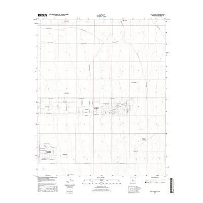
2017 Map of Los Lunas SE
USGS Topo · Published 2017About this map
Meadow Lake and the developing residential grid of El Cerro Mission sit on the high desert plains east of the Rio Grande valley. This 2017 survey details a landscape transitioning from open range into organized subdivisions, particularly along the Mesa Estates Rd corridor. While the southern sections show concentrated street layouts like Saint Thomas Ave and San Pasquale Ave, the northern reaches remain defined by high-desert terrain and a network of Bureau of Indian Affairs routes, including Indian Svc Rte 625 and Indian Svc Rte 627. Natural water sources like Maes Spring and Carrizo Spring provide a sharp contrast to the nearby Manzano- Mountain Air Ranch airfield. The map serves as a primary reference for the late-twentieth-century growth and rural-to-suburban shift in this part of Valencia County.
Find a feature on this map
48 named features on this map. Tap any name to fly to it.
Don’t see what you’re looking for? This feature index may not catch every label — zoom into the map to look around manually.
Map Details
Editions of this 2017 Los Lunas SE Map
This is the sole edition of this map. No revisions or reprints were ever made.
Other maps of this area

1917 · Estancia
USGS Topo · 1:125,000

1952 · Tome NE
USGS Topo · 1:24,000

1952 · Hubbell Spring
USGS Topo · 1:24,000

1952 · Tome
USGS Topo · 1:24,000

1952 · Los Lunas SE
USGS Topo · 1:24,000

1952 · Los Lunas
USGS Topo · 1:24,000

1952 · Isleta
USGS Topo · 1:24,000

1954 · Bosque Peak
USGS Topo · 1:24,000

1954 · Capilla Peak
USGS Topo · 1:24,000

1954 · Mount Washington
USGS Topo · 1:24,000