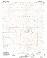
1991 Map of Los Lunas SE
USGS Topo · Published 1996About this map
The Isleta Pueblo Indian Reservation occupies much of this high desert landscape, characterized by complex land tenure dating back to early Spanish grants. The terrain is divided into historic territories including the Lo De Padilla Grant, the Juan Otero Grant, and the Tome Grant, reflecting the deep colonial and indigenous history of Valencia County. A specific northern section is designated as the Lo De Padilla Grant (Peralta Tract), while surveying markers such as the Pueblo Grant Bdy delineate these ancestral and administrative boundaries.
Find a feature on this map
12 named features on this map. Tap any name to fly to it.
Don’t see what you’re looking for? This feature index may not catch every label — zoom into the map to look around manually.
Map Details
Editions of this 1991 Los Lunas SE Map
This is the sole edition of this map. No revisions or reprints were ever made.
Other maps of this area

1917 · Estancia
USGS Topo · 1:125,000

1952 · Tome NE
USGS Topo · 1:24,000

1952 · Hubbell Spring
USGS Topo · 1:24,000

1952 · Tome
USGS Topo · 1:24,000

1952 · Los Lunas SE
USGS Topo · 1:24,000

1952 · Los Lunas
USGS Topo · 1:24,000

1952 · Isleta
USGS Topo · 1:24,000

1954 · Bosque Peak
USGS Topo · 1:24,000

1954 · Capilla Peak
USGS Topo · 1:24,000

1954 · Mount Washington
USGS Topo · 1:24,000