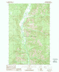
1989 Map of Louie Creek
USGS Topo · Published 1989About this map
The Colville Indian Reservation encompasses this rugged drainage basin where the Sanpoil River flows southward through a deep mountain valley. The landscape is defined by its dramatic hydrology, with numerous named tributaries such as Bridge Creek, Louie Creek, and McAllister Creek carving into the surrounding slopes. This 1989 topographic study highlights the isolation and physical character of the terrain during the late twentieth century, showing a region largely shaped by the natural contours of the land rather than dense settlement.
Find a feature on this map
16 named features on this map. Tap any name to fly to it.
Don’t see what you’re looking for? This feature index may not catch every label — zoom into the map to look around manually.
Map Details
Editions of this 1989 Louie Creek Map
2 editions found
Other maps of this area

1950 · Nespelem
USGS Topo · 1:62,500

1952 · Keller
USGS Topo · 1:62,500

1953 · Seventeenmile Mtn.
USGS Topo · 1:62,500

1953 · Bald Knob
USGS Topo · 1:62,500

1954 · Okanogan
USGS Topo · 1:250,000

1958 · Okanogan
USGS Topo · 1:250,000

1984 · Nespelem
USGS Topo · 1:100,000

1986 · Central Peak
USGS Topo · 1:24,000
1989 · Keller
USGS Topo · 1:24,000
1989 · Nespelem NE
USGS Topo · 1:24,000