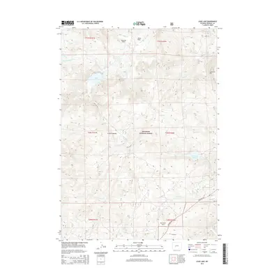
2015 Map of Louis Lake
USGS Topo · Published 2015About this map
Shoshone National Forest defines this high-elevation landscape in Fremont County, where the southern Wind River Range transitions into alpine basins and meadows. The hydrography of the region is centered on Louis Lake and the Little Popo Agie River, with a complex network of tributaries including Rock Cr, Little Rock Cr, and Pass Cr draining the eastern slopes. Evidence of land use and access is carved into the terrain via Louis Lake Rd and the historic Indian Trl, while landmarks like Limestone Mtn and Sherwood Point offer clear orientation points for high-country navigation. The presence of the Upper Rock Cr Reservoir and named clearings such as Grannier Meadow suggest a long-standing history of water management and seasonal grazing. This 2015 update from the U.S. Geological Survey details the remote drainage systems of Slate Cr and Willow Cr alongside the prominent geological formation of Big Hermit Gulch.
Find a feature on this map
28 named features on this map. Tap any name to fly to it.
Don’t see what you’re looking for? This feature index may not catch every label — zoom into the map to look around manually.
Map Details
Editions of this 2015 Louis Lake Map
This is the sole edition of this map. No revisions or reprints were ever made.
Other maps of this area

1953 · Cony Mountain
USGS Topo · 1:24,000

1953 · Atlantic City
USGS Topo · 1:24,000

1953 · Fossil Hill
USGS Topo · 1:24,000

1953 · Louis Lake
USGS Topo · 1:24,000

1953 · South Pass City
USGS Topo · 1:24,000

1953 · Christina Lake
USGS Topo · 1:24,000

1954 · Wolf Point
USGS Topo · 1:24,000

1954 · Miners Delight
USGS Topo · 1:24,000

1955 · Lander
USGS Topo · 1:250,000

1958 · Lander
USGS Topo · 1:250,000