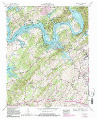
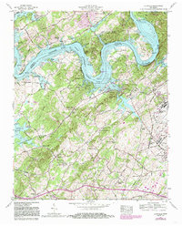
1968 Map of Louisville
USGS Topo · Published 1985About this map
Fort Loudoun Lake dominates the landscape as it winds through the borderlands of Knox and Blount counties. The town of Louisville sits at the center of this riverside network, serving as a focal point for local commerce and community life during the late 1960s. To the south, the expansion of Mcgee Tyson Airport and the neighboring industrial presence of Alcoa signal the region's modernization, while several smaller, rural hubs like Middle Settlement and Miser Station maintain their traditional character.
Find a feature on this map
72 named features on this map. Tap any name to fly to it.
Don’t see what you’re looking for? This feature index may not catch every label — zoom into the map to look around manually.
Map Details
Editions of this 1968 Louisville Map
5 editions found
Other maps of this area

1886 · Knoxville
USGS Topo · 1:125,000

1892 · Knoxville
USGS Topo · 1:125,000

1894 · Knoxville
USGS Topo · 1:125,000

1895 · Loudon
USGS Topo · 1:125,000

1895 · Knoxville
USGS Topo · 1:125,000

1901 · Knoxville
USGS Topo · 1:125,000

1935 · Binfield
USGS Topo · 1:24,000

1935 · Knoxville
USGS Topo · 1:48,000

1935 · Meadow
USGS Topo · 1:24,000

1935 · Maryville
USGS Topo · 1:24,000