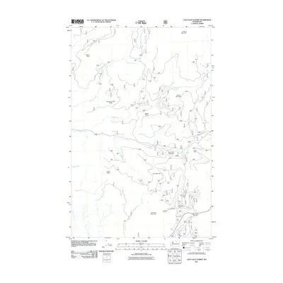
2011 Map of Loup Loup Summit
USGS Topo · Published 2011About this map
Loup Loup Summit serves as a high-altitude focal point for this section of the Okanogan National Forest, where recreation and topography converge. The landscape is defined by a series of prominent peaks and ridgelines, including Granite Mountain, Bobcat Mountain, and Little Buck Mountain. Water systems like South Fork Beaver Creek and Lightning Creek drain these highlands, creating fertile pockets such as South Fork Meadows. The presence of the Loup Loup Ski Area, Loup Loup Campground, and the J R Picnic Area near the summit indicates a well-established destination for winter sports and summer activities. For local historians and researchers, the map documents specific forest service camps like Leighty Camp and Hidden Camp, providing a detailed record of land use and recreational infrastructure in the early twenty-first century.
Find a feature on this map
26 named features on this map. Tap any name to fly to it.
Don’t see what you’re looking for? This feature index may not catch every label — zoom into the map to look around manually.
Map Details
Editions of this 2011 Loup Loup Summit Map
This is the sole edition of this map. No revisions or reprints were ever made.
Other maps of this area

1899 · Methow
USGS Topo · 1:125,000

1901 · Methow
USGS Topo · 1:125,000

1905 · Okanogan
USGS Topo · 1:125,000

1906 · Chopaka
USGS Topo · 1:125,000

1954 · Okanogan
USGS Topo · 1:250,000

1955 · Concrete
USGS Topo · 1:250,000

1956 · Loup Loup
USGS Topo · 1:62,500

1956 · Tiffany Mountain
USGS Topo · 1:62,500

1958 · Concrete
USGS Topo · 1:250,000

1958 · Okanogan
USGS Topo · 1:250,000