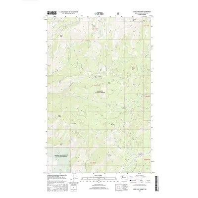
2017 Map of Loup Loup Summit
USGS Topo · Published 2017About this map
The Okanogan National Forest covers the majority of this high-altitude landscape, where the peaks of the North Cascades transition into the drainage basins of the Methow Valley. High points like Granite Mountain and Bobcat Mtn overlook a complex network of forest development roads, including Nat For Dev Rd 4235 and Nat For Dev Rd 4200, which provide access for logging and conservation efforts. To the southwest, the Methow Winter Range and Wildlife Refuge indicates the area's importance for local fauna. The topography is defined by significant landmarks such as Loup Loup Summit and the broad South Fork Meadows. Water moves through the terrain via several branches of Beaver Creek, including Mid Beaver Creek and the S Fork Beaver Cr, alongside smaller features like Beaver Lake and Storer Cr.
Find a feature on this map
60 named features on this map. Tap any name to fly to it.
Don’t see what you’re looking for? This feature index may not catch every label — zoom into the map to look around manually.
Map Details
Editions of this 2017 Loup Loup Summit Map
This is the sole edition of this map. No revisions or reprints were ever made.
Other maps of this area

1899 · Methow
USGS Topo · 1:125,000

1901 · Methow
USGS Topo · 1:125,000

1905 · Okanogan
USGS Topo · 1:125,000

1906 · Chopaka
USGS Topo · 1:125,000

1954 · Okanogan
USGS Topo · 1:250,000

1955 · Concrete
USGS Topo · 1:250,000

1956 · Loup Loup
USGS Topo · 1:62,500

1956 · Tiffany Mountain
USGS Topo · 1:62,500

1958 · Concrete
USGS Topo · 1:250,000

1958 · Okanogan
USGS Topo · 1:250,000