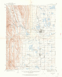
1906 Map of Loveland
USGS Topo · Published 1963About this map
Loveland and Berthoud anchor this early 20th-century landscape where the agricultural plains meet the foothills of the Roosevelt National Forest. The complex irrigation network of the Louden Ditch and numerous reservoirs like Lake Loveland and Fossil Creek Reservoir reveal a high-desert environment being rapidly transformed by engineering. Smaller settlements such as Masonville, Arkins, and Campion are connected by the Colorado and Southern RR, highlighting the importance of rail transport for both passengers and the region's produce. Industrial and infrastructure landmarks, including the Flaster Mill and a Filter Bed near Green Ridge, demonstrate the technical advancements required to manage the Big Thompson Canyon watershed. This topographic study captures the precise moment when Northern Colorado's water management and transportation systems were first formalizing the modern footprint of these communities.
Find a feature on this map
78 named features on this map. Tap any name to fly to it.
Don’t see what you’re looking for? This feature index may not catch every label — zoom into the map to look around manually.
Map Details
Editions of this 1906 Loveland Map
5 editions found
Other maps of this area

1902 · Greeley
USGS Topo · 1:125,000

1902 · Boulder
USGS Topo · 1:62,500

1904 · Niwot
USGS Topo · 1:62,500

1904 · Boulder
USGS Topo · 1:62,500

1905 · Mount Olympus
USGS Topo · 1:62,500

1906 · Loveland
USGS Topo · 1:62,500

1906 · Fort Collins
USGS Topo · 1:62,500

1907 · Mount Olympus
USGS Topo · 1:62,500

1907 · Livermore
USGS Topo · 1:125,000

1908 · Loveland
USGS Topo · 1:62,500