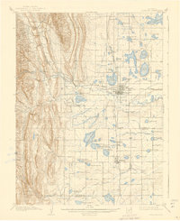
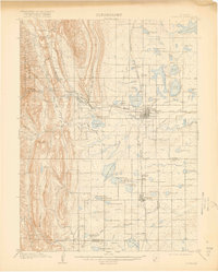
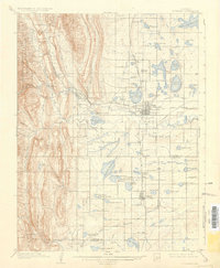
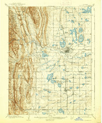
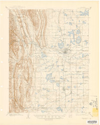
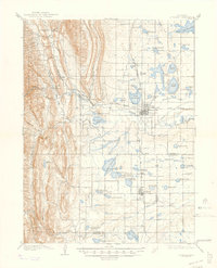
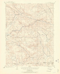
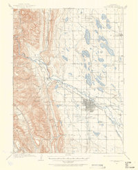
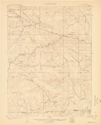
1908 Map of Loveland
USGS Topo · Published 1939About this map
The Big Thompson River cuts through this landscape, fueling an intricate network of irrigation ditches and canals that turned this region into a productive agricultural hub at the turn of the century. Emerging from the Roosevelt National Forest and passing the Plaster Mill, the river supports a complex system of water management including the Greeley and Loveland Canal, Barnes Ditch, and Farmers Ditch. This reliance on water engineering is further evidenced by the massive Fossil Creek Reservoir and the multiple basins of Boyd Lakes.
Find a feature on this map
76 named features on this map. Tap any name to fly to it.
Don’t see what you’re looking for? This feature index may not catch every label — zoom into the map to look around manually.
Map Details
Editions of this 1908 Loveland Map
7 editions found
Other maps of this area

1902 · Greeley
USGS Topo · 1:125,000

1902 · Boulder
USGS Topo · 1:62,500

1904 · Niwot
USGS Topo · 1:62,500

1904 · Boulder
USGS Topo · 1:62,500
1905 · Mount Olympus
USGS Topo · 1:62,500

1906 · Loveland
USGS Topo · 1:62,500
1906 · Fort Collins
USGS Topo · 1:62,500
1907 · Mount Olympus
USGS Topo · 1:62,500
1907 · Livermore
USGS Topo · 1:125,000

1908 · Loveland
USGS Topo · 1:62,500