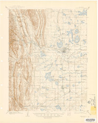
1908 Map of Loveland
USGS Topo · Published 1944About this map
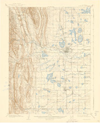
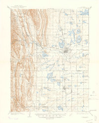
Loveland and Berthoud anchor this detailed survey of the Colorado Front Range, captured as the region’s irrigation infrastructure was undergoing massive expansion. The Big Thompson River serves as the primary artery for a complex network of man-made waterways, including the Louden Ditch, Barnes Ditch, and the Loveland and Greeley Canal. These systems transformed the arid plains into productive agricultural land, fueling the growth of early 20th-century sugar beet and plaster industries. Industrial heritage is marked by the Plaster Mill near Arkins and the tracks of the Great Western RR. To the west, the landscape rises sharply into the Roosevelt National Forest, where peaks like Flatiron Mtn and the narrow Loveland Canyon contrast with the meticulously engineered reservoirs of the valley floor, such as Lake Loveland and the Boyd Lakes.
Find a feature on this map
75 named features on this map. Tap any name to fly to it.
Don’t see what you’re looking for? This feature index may not catch every label — zoom into the map to look around manually.
Map Details
Editions of this 1908 Loveland Map
7 editions found
Other maps of this area

1902 · Greeley
USGS Topo · 1:125,000

1902 · Boulder
USGS Topo · 1:62,500

1904 · Niwot
USGS Topo · 1:62,500

1904 · Boulder
USGS Topo · 1:62,500

1905 · Mount Olympus
USGS Topo · 1:62,500

1906 · Loveland
USGS Topo · 1:62,500

1906 · Fort Collins
USGS Topo · 1:62,500

1907 · Mount Olympus
USGS Topo · 1:62,500

1907 · Livermore
USGS Topo · 1:125,000

1908 · Loveland
USGS Topo · 1:62,500