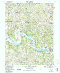
1994 Map of Lowell
USGS Topo · Published 1998About this map
The Muskingum River dominates this portion of Washington and Morgan Counties, carving a deep valley that dictates the region's settlement patterns and transport routes. Along its banks, the river-oriented communities of Lowell, Upper Lowell, and Coal Run serve as anchors for the surrounding rural townships. The landscape is heavily marked by the region's heritage of family farming and faith, evidenced by numerous burial grounds like Round Bottom Cem and Dodge Cem, alongside rural landmarks such as Our Lady of Mercy Ch and Salem Ch.
Find a feature on this map
51 named features on this map. Tap any name to fly to it.
Don’t see what you’re looking for? This feature index may not catch every label — zoom into the map to look around manually.
Map Details
Editions of this 1994 Lowell Map
This is the sole edition of this map. No revisions or reprints were ever made.
Other maps of this area

1902 · Parkersburg
USGS Topo · 1:62,500

1903 · Macksburg
USGS Topo · 1:62,500

1904 · Parkersburg
USGS Topo · 1:62,500

1904 · Marietta
USGS Topo · 1:62,500

1905 · Macksburg
USGS Topo · 1:62,500

1909 · Caldwell
USGS Topo · 1:62,500

1912 · Caldwell
USGS Topo · 1:62,500

1924 · Marietta
USGS Topo · 1:62,500

1927 · Marietta
USGS Topo · 1:62,500

1949 · Clarksburg
USGS Topo · 1:250,000