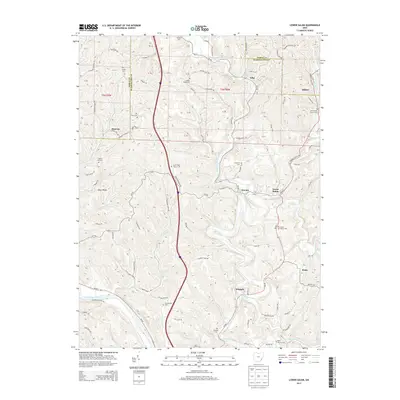
2013 Map of Lower Salem
USGS Topo · Published 2013About this map
The Duck Creek valley serves as the primary corridor for settlement and transit across this portion of Washington and Noble counties. Small communities and historic hamlets follow the winding path of the water, with Lower Salem and Whipple anchoring the southern and central sections of the quadrangle. The landscape is characterized by a dense network of ridge roads, including Dixon Ridge and Atherton Ridge Rd, which connect the upland farms and hilltop cemeteries that define the local genealogy.
Find a feature on this map
119 named features on this map. Tap any name to fly to it.
Don’t see what you’re looking for? This feature index may not catch every label — zoom into the map to look around manually.
Map Details
Editions of this 2013 Lower Salem Map
This is the sole edition of this map. No revisions or reprints were ever made.
Other maps of this area

1902 · Parkersburg
USGS Topo · 1:62,500

1903 · Macksburg
USGS Topo · 1:62,500

1904 · Parkersburg
USGS Topo · 1:62,500

1904 · Marietta
USGS Topo · 1:62,500

1905 · Macksburg
USGS Topo · 1:62,500

1909 · Caldwell
USGS Topo · 1:62,500

1912 · Caldwell
USGS Topo · 1:62,500

1924 · Marietta
USGS Topo · 1:62,500

1927 · Marietta
USGS Topo · 1:62,500

1949 · Clarksburg
USGS Topo · 1:250,000