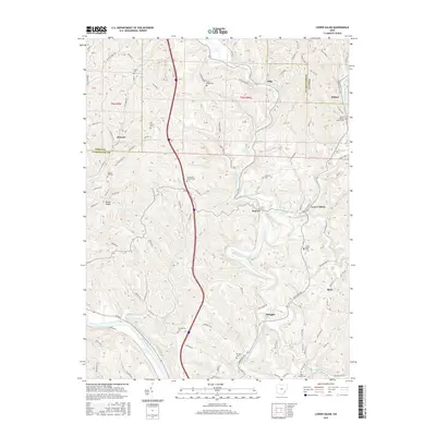
2016 Map of Lower Salem
USGS Topo · Published 2016About this map
The West Fork Duck Creek and East Fork Duck Creek converge near Lower Salem, shaping a landscape of deep valleys and prominent ridges in southeast Ohio. This survey captures a network of rural settlements including Honesty, Elba, and Bonn, connected by winding township roads that follow the difficult topography of Dixon Ridge and Bakers Ridge. The area is characterized by its numerous small burial grounds and parish sites, such as Smith Ridge Cem and the Mount Ephriam Church, which serve as vital markers for local family history and genealogy. Along the southern edge of the map, the Muskingum River cuts a wide path, while smaller tributaries like Bear Cr and Cats Creek drain the surrounding hills. The map provides a detailed view of the 19th-century land divisions, showing the enduring section lines and township boundaries of T5N R9W and T5N R8W.
Find a feature on this map
114 named features on this map. Tap any name to fly to it.
Don’t see what you’re looking for? This feature index may not catch every label — zoom into the map to look around manually.
Map Details
Editions of this 2016 Lower Salem Map
This is the sole edition of this map. No revisions or reprints were ever made.
Other maps of this area

1902 · Parkersburg
USGS Topo · 1:62,500

1903 · Macksburg
USGS Topo · 1:62,500

1904 · Parkersburg
USGS Topo · 1:62,500

1904 · Marietta
USGS Topo · 1:62,500

1905 · Macksburg
USGS Topo · 1:62,500

1909 · Caldwell
USGS Topo · 1:62,500

1912 · Caldwell
USGS Topo · 1:62,500

1924 · Marietta
USGS Topo · 1:62,500

1927 · Marietta
USGS Topo · 1:62,500

1949 · Clarksburg
USGS Topo · 1:250,000