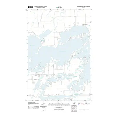
2010 Map of Lower Whitefish Lake
USGS Topo · Published 2010About this map
Lower Whitefish Lake and its intricate network of surrounding basins define this portion of the northern woods in the early 2000s. The landscape is a dense archipelago of water and land, featuring named points of interest such as Big Trout Lake, Pig Lake, and Clamshell Lake. Human settlement is concentrated in small pockets like Manhattan Beach, where the Manhattan Beach Post Office serves the local community, and the rural junction of Swanburg further north.
Find a feature on this map
82 named features on this map. Tap any name to fly to it.
Don’t see what you’re looking for? This feature index may not catch every label — zoom into the map to look around manually.
Map Details
Editions of this 2010 Lower Whitefish Lake Map
This is the sole edition of this map. No revisions or reprints were ever made.
Other maps of this area

1953 · Brainerd
USGS Topo · 1:250,000

1957 · Brainerd
USGS Topo · 1:250,000

1958 · Brainerd
USGS Topo · 1:250,000

1959 · Trommald
USGS Topo · 1:24,000

1959 · Pelican Lake
USGS Topo · 1:24,000

1959 · Nisswa
USGS Topo · 1:24,000

1959 · Lower Whitefish Lake
USGS Topo · 1:24,000

1959 · Jenkins
USGS Topo · 1:24,000

1960 · Cross Lake
USGS Topo · 1:24,000

1965 · Brainerd
USGS Topo · 1:250,000