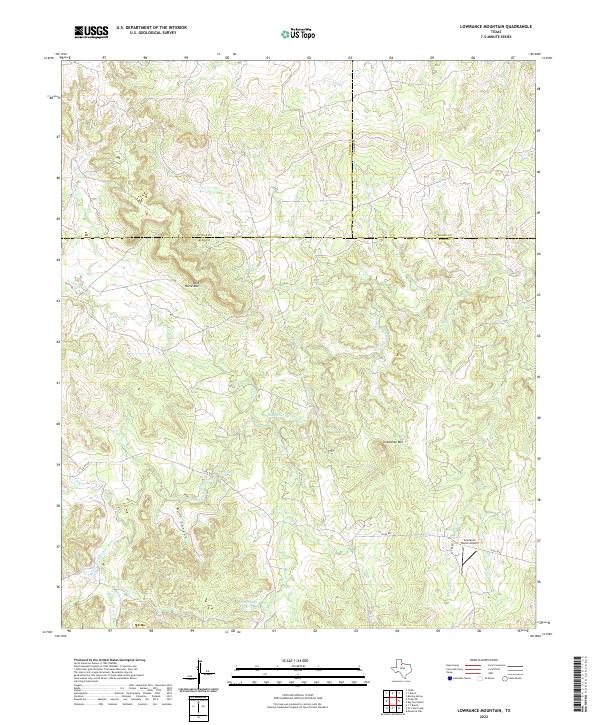
2022 Map of Lowrance Mountain
USGS Topo · Published 2022About this map
Lowrance Mtn and Wild Horse Mtn dominate this section of West Texas where the boundaries of King, Cottle, and Foard counties meet. The landscape is defined by the winding course of the Middle Fork Wichita River, which carves through the terrain alongside several tributary drainages including Farrer Cr and Bull Canyon. Settlement in this area is sparse, characterized by large-scale ranching operations and isolated infrastructure like the Lowrance Ranch Airport.
Find a feature on this map
15 named features on this map. Tap any name to fly to it.
Don’t see what you’re looking for? This feature index may not catch every label — zoom into the map to look around manually.
Map Details
Editions of this 2022 Lowrance Mountain Map
This is the sole edition of this map. No revisions or reprints were ever made.
Other maps of this area

1954 · Lubbock
USGS Topo · 1:250,000

1954 · Wichita Falls
USGS Topo · 1:250,000

1958 · Wichita Falls
USGS Topo · 1:250,000

1966 · Ox Yoke Creek
USGS Topo · 1:24,000

1966 · Chalk SW
USGS Topo · 1:24,000

1966 · Big Four Ranch
USGS Topo · 1:24,000

1966 · J Y Ranch
USGS Topo · 1:24,000

1966 · Maverick Flat
USGS Topo · 1:24,000

1966 · Lowrance Mountain
USGS Topo · 1:24,000

1968 · Y Ranch
USGS Topo · 1:24,000