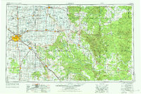
1954 Map of Lubbock
USGS Topo · Published 1976About this map
The High Plains of the Llano Estacado meet the rolling breaks of the Brazos River watershed in this mid-century survey of West Texas. Lubbock serves as the regional hub, where the Santa Fe railroad and extensive highway networks radiate toward satellite farming towns like Idalou, Ralls, and Abernathy. The landscape is defined by its drainage patterns, from the flat tableland pockmarked with Numerous Small Intermittent Lakes and larger saline basins like Double Lakes and Tahoka Lake, to the dramatic incisions of Blanco Canyon and Yellow House Canyon. To the east, the terrain drops off the Caprock escarpment into a more dissected territory of red-soil ranching country and peaks such as Soldier Mound and the prominent Double Mountains. This era shows the region’s development through oil and gas infrastructure, visible in various substations and field patterns, alongside recreational landmarks like Mackenzie St Pk and Buffalo Springs Lake.
Find a feature on this map
120 named features on this map. Tap any name to fly to it.
Don’t see what you’re looking for? This feature index may not catch every label — zoom into the map to look around manually.
Map Details
Editions of this 1954 Lubbock Map
4 editions found

Other maps of this area

1891 · Anson
USGS Topo · 1:125,000

1893 · Roby
USGS Topo · 1:125,000

1893 · Anson
USGS Topo · 1:125,000

1925 · Aspermont 4-a
USGS Topo · 1:48,000

1925 · Haskell 3-b
USGS Topo · 1:48,000

1926 · Snyder 1-a
USGS Topo · 1:48,000

1926 · Roby 2-b
USGS Topo · 1:48,000

1931 · Rotan
USGS Topo · 1:62,500

1931 · Aspermont
USGS Topo · 1:62,500

1932 · Vivian
USGS Topo · 1:62,500