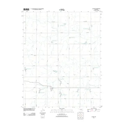
2012 Map of Lucien
USGS Topo · Published 2012About this map
Lucien serves as the primary settlement hub in this part of Noble County, centered near the intersection of 2nd St and 4th St. The surrounding landscape is defined by a sophisticated water management system consisting of numerous flood control structures, including Upper Black Bear Cr Site 50 Reservoir and Upper Black Bear Cr Site 47 Reservoir. These reservoirs are scattered across the drainage basins of Black Bear Cr, Panther Cr, and Turkey Cr, illustrating the region's historical efforts to manage agricultural runoff and creek levels.
Find a feature on this map
45 named features on this map. Tap any name to fly to it.
Don’t see what you’re looking for? This feature index may not catch every label — zoom into the map to look around manually.
Map Details
Editions of this 2012 Lucien Map
This is the sole edition of this map. No revisions or reprints were ever made.
Other maps of this area

1893 · Mulhall
USGS Topo · 1:62,500

1893 · Lovell
USGS Topo · 1:62,500

1955 · Enid
USGS Topo · 1:250,000

1956 · Garber
USGS Topo · 1:62,500

1958 · Enid
USGS Topo · 1:250,000

1972 · Perry NW
USGS Topo · 1:24,000

1972 · Ceres
USGS Topo · 1:24,000

1972 · Perry
USGS Topo · 1:24,000

1972 · Lucien
USGS Topo · 1:24,000
1974 · Orlando East
USGS Topo · 1:24,000