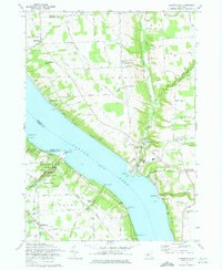
1971 Map of Ludlowville
USGS Topo · Published 1975About this map
Cayuga Lake dominates this 1971 survey, showing the deep glacial finger lake bordered by the townships of Lansing, Ulysses, Covert, and Genoa. The western shore is defined by the dramatic geology of Taughannock Falls State Park, where Taughannock Creek carves a massive gorge toward the water. On the eastern shore, the Lehigh Valley railroad line hugs the coast, serving industrial and transit points like Myers and Portland Pt, where a large Quarry is noted near the water's edge.
Find a feature on this map
52 named features on this map. Tap any name to fly to it.
Don’t see what you’re looking for? This feature index may not catch every label — zoom into the map to look around manually.
Map Details
Editions of this 1971 Ludlowville Map
2 editions found
Other maps of this area

1893 · Ithaca
USGS Topo · 1:62,500

1895 · Ithaca
USGS Topo · 1:62,500

1898 · Moravia
USGS Topo · 1:62,500

1900 · Dryden
USGS Topo · 1:62,500

1902 · Moravia
USGS Topo · 1:62,500

1902 · Genoa
USGS Topo · 1:62,500

1905 · Watkins Glen
USGS Topo · 1:125,000

1906 · Catatonk
USGS Topo · 1:125,000

1942 · Ludlowville
USGS Topo · 1:24,000

1942 · Sheldrake
USGS Topo · 1:24,000