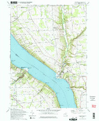
1971 Map of Ludlowville
USGS Topo · Published 1975About this map
Taughannock Falls State Park dominates the western shore of the Finger Lakes in this early 1970s record, showcasing the dramatic gorge where Taughannock Creek drops over Taughannock Falls toward the water. Across Cayuga Lake, the eastern shore is defined by the industrial and transport corridor of the Lehigh Valley Railroad, which skirts the shoreline past Ludlowville and Myers. The map reveals a landscape of high plateaus deeply incised by drainages like Salmon Creek and Morrow Creek, where upland agriculture meets the growing residential footprints of South Lansing and Jacksonville. Genealogists will find numerous family-named landmarks and rural burial grounds, including Bower Cem and Pine Grove Cem, alongside mid-century lakeside developments such as Camp Barton and Camp Comstock. The presence of a Quarry near Portland Pt and several Gravel Pits underscores the local extraction industry during this era.
Find a feature on this map
78 named features on this map. Tap any name to fly to it.
Don’t see what you’re looking for? This feature index may not catch every label — zoom into the map to look around manually.
Map Details
Editions of this 1971 Ludlowville Map
2 editions found
Other maps of this area

1893 · Ithaca
USGS Topo · 1:62,500

1895 · Ithaca
USGS Topo · 1:62,500

1898 · Moravia
USGS Topo · 1:62,500

1900 · Dryden
USGS Topo · 1:62,500

1902 · Moravia
USGS Topo · 1:62,500

1902 · Genoa
USGS Topo · 1:62,500

1905 · Watkins Glen
USGS Topo · 1:125,000

1906 · Catatonk
USGS Topo · 1:125,000

1942 · Ludlowville
USGS Topo · 1:24,000

1942 · Sheldrake
USGS Topo · 1:24,000