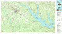
1992 Map of Lufkin
USGS Topo · Published 1992About this map
Deep pine forests and extensive river drainages define the landscape around Lufkin in the early 1990s. The massive Sam Rayburn Reservoir dominates the eastern half of the sheet, its irregular shoreline reaching into the Angelina National Forest and meeting the Angelina River. The map details the region's industrial and rural foundations, showing the Angelina & Neches River RR and Texas Southeastern RR serving timber and transit hubs like Diboll. To the west, the Davy Crockett National Forest provides a buffer for smaller settlements such as Pollok and Centralia. Genealogists will find significant value in the documentation of family-named landmarks and rural institutions, including the Beulah Ch, Prairie Grove Cem, and isolated communities like Manning. This survey also captures the local topography of Shawnee Prairie and the numerous bayous and creeks that feed the reservoir system.
Find a feature on this map
141 named features on this map. Tap any name to fly to it.
Don’t see what you’re looking for? This feature index may not catch every label — zoom into the map to look around manually.
Map Details
Editions of this 1992 Lufkin Map
This is the sole edition of this map. No revisions or reprints were ever made.
Other maps of this area

1927 · Lufkin 4-c
USGS Topo · 1:24,000

1928 · Zavalla 3-c
USGS Topo · 1:24,000

1928 · Lufkin 4-d
USGS Topo · 1:24,000

1931 · Zavalla
USGS Topo · 1:62,500

1932 · Manning
USGS Topo · 1:62,500

1944 · Patroon
USGS Topo · 1:62,500

1946 · Alto
USGS Topo · 1:62,500

1949 · Lufkin
USGS Topo · 1:62,500

1949 · Platt
USGS Topo · 1:24,000

1949 · Clawson
USGS Topo · 1:24,000