
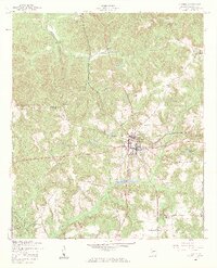
1955 Map of Lumpkin
USGS Topo · Published 1959About this map
Lumpkin serves as the central hub of Stewart County in the mid-1950s, defined by the crossroads of regional highways and the Seaboard Air Line railroad. This survey reveals a landscape deeply connected to its local institutions, with numerous country churches and segregated-era schools dotting the periphery. To the west, Shady Grove Ch and Greater New Hope Ch anchor rural communities, while the Dowd Sch and Green Grove Sch suggest the educational layout of the time.
Find a feature on this map
26 named features on this map. Tap any name to fly to it.
Don’t see what you’re looking for? This feature index may not catch every label — zoom into the map to look around manually.
Map Details
Editions of this 1955 Lumpkin Map
3 editions found
Other maps of this area

1949 · Julia
USGS Topo · 1:24,000

1950 · Louvale
USGS Topo · 1:24,000

1950 · Lumpkin
USGS Topo · 1:24,000

1950 · Lumpkin SW
USGS Topo · 1:24,000

1950 · Lumpkin
USGS Topo · 1:62,500

1953 · Dothan
USGS Topo · 1:250,000

1954 · Dothan
USGS Topo · 1:250,000

1955 · Dothan
USGS Topo · 1:250,000
1955 · Louvale
USGS Topo · 1:24,000

1955 · Lumpkin SW
USGS Topo · 1:24,000