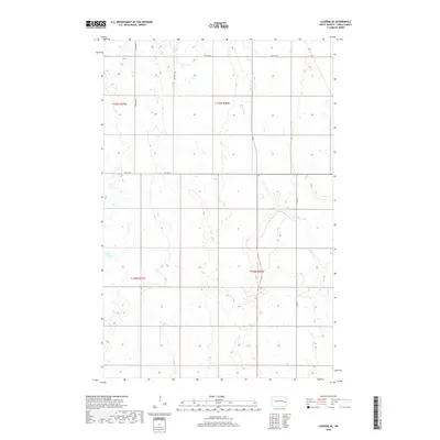
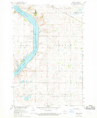
2018 Map of Luverne SE
USGS Topo · Published 2018About this map
The Maple River winds through the southeastern portion of Steele County, defining the drainage patterns of this agricultural landscape in the late 2010s. The terrain is characterized by a grid of rural section roads, including 129th Ave SE, 127th Ave SE, and 6th St SE, which facilitate the movement of goods across this prairie region. Major local arteries such as CO Hwy 8A and CO Hwy 5 connect the various townships. This survey provides a precise look at the township and range divisions, showing the intersections of t145n r57w, t145n r56w, t144n r57w, and t144n r56w. The presence of numerous wetlands and the meandering path of the river underscore the natural water management systems that coexist with the established farming infrastructure of the area.
Find a feature on this map
12 named features on this map. Tap any name to fly to it.
Don’t see what you’re looking for? This feature index may not catch every label — zoom into the map to look around manually.
Map Details
Editions of this 2018 Luverne SE Map
This is the sole edition of this map. No revisions or reprints were ever made.
Other maps of this area

1952 · Grand Forks
USGS Topo · 1:250,000

1956 · Grand Forks
USGS Topo · 1:250,000

1966 · Grand Forks
USGS Topo · 1:250,000

1967 · Blabon
USGS Topo · 1:24,000
1967 · Luverne
USGS Topo · 1:24,000
1967 · Pillsbury
USGS Topo · 1:24,000
1967 · Luverne NW
USGS Topo · 1:24,000

1967 · Colgate
USGS Topo · 1:24,000
1967 · Sibley
USGS Topo · 1:24,000

1967 · Luverne SE
USGS Topo · 1:24,000
Featured Places
- Carpenter Township, ND
- Melrose Township, ND
- Riverside Township, ND
- Willow Lake Township, ND
- Steele County, ND