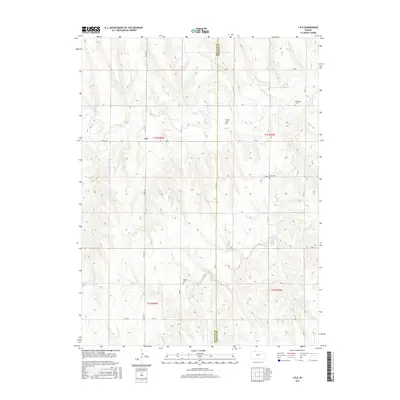
2015 Map of Lyle
USGS Topo · Published 2015About this map
Lyle sits at the intersection of Co RD 509 and Co RD 308, serving as the primary reference point in this corner of Northwest Kansas near the Decatur Co Norton Co line. The landscape is defined by the dendritic drainage of Sappa Cr and its tributaries, including Long Br and Spring Br, which carve through the plains. The distribution of small family or community burial grounds across the sections reflects a history of decentralized rural settlement and homesteading. Genealogists and local historians can locate specific sites such as Railsback Cem in the northeast, Wotton Cem and Wray Cem centrally located near RD D, and Shirley Cem to the south. The road network, primarily composed of section-line routes like RD 8 and RD W-15, maintains the traditional grid of the Public Land Survey System.
Find a feature on this map
27 named features on this map. Tap any name to fly to it.
Don’t see what you’re looking for? This feature index may not catch every label — zoom into the map to look around manually.
Map Details
Editions of this 2015 Lyle Map
This is the sole edition of this map. No revisions or reprints were ever made.
Other maps of this area

1951 · Norcatur
USGS Topo · 1:62,500

1951 · Kanona
USGS Topo · 1:62,500

1954 · McCook
USGS Topo · 1:250,000

1954 · Goodland
USGS Topo · 1:250,000

1956 · Goodland
USGS Topo · 1:250,000

1957 · McCook
USGS Topo · 1:250,000

1957 · Goodland
USGS Topo · 1:250,000

1957 · Shippee
USGS Topo · 1:24,000
1957 · Wilsonville
USGS Topo · 1:24,000

1957 · Lebanon
USGS Topo · 1:24,000