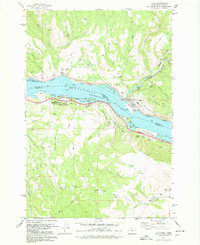
1978 Map of Lyle
USGS Topo · Published 1978About this map
The Columbia River serves as the central artery for this late-1970s survey, dividing the Klickitat County, Washington, shoreline from Wasco County, Oregon. On the northern bank, the town of Lyle sits at the base of the Columbia Hills, where the Burlington Northern railroad follows the water's edge past the Lyle Cem and Chamberlain Lake. Across the water, the landscape transitions into the steep terrain of Rowena Dell and Sevenmile Hill. Transport and recreation define the riverfront, marked by the Pacific Highway and the Memaloose State Park, which encompasses the Memaloose Islands and the Memaloose Overlook. Smaller settlements like Rowena and Chatfield appear alongside industrial markers such as numerous quarries and gravel pits, reflecting the area's geological utility. The presence of Pioneer Road and Jeep Trails heading into the hills highlights a landscape that, while modernization continues, still retains its rugged and historical character.
Find a feature on this map
68 named features on this map. Tap any name to fly to it.
Don’t see what you’re looking for? This feature index may not catch every label — zoom into the map to look around manually.
Map Details
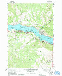
Editions of this 1978 Lyle Map
2 editions found
Other maps of this area

1934 · The Dalles
USGS Topo · 1:125,000

1953 · The Dalles
USGS Topo · 1:250,000

1956 · The Dalles
USGS Topo · 1:250,000

1957 · The Dalles
USGS Topo · 1:250,000

1957 · Klickitat
USGS Topo · 1:62,500

1957 · The Dalles
USGS Topo · 1:62,500

1957 · White Salmon
USGS Topo · 1:62,500

1957 · Husum
USGS Topo · 1:62,500

1974 · The Dalles North
USGS Topo · 1:24,000
1974 · Brown Creek
USGS Topo · 1:24,000