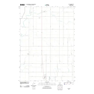
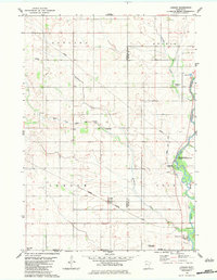
2010 Map of Lyle
USGS Topo · Published 2010About this map
The settlement of Lyle sits at the southern edge of Mower County, directly adjacent to the Iowa border. This 2010 topographic record captures the grid-patterned development of the town, including the location of the Lyle Post Office. To the north, the small community of Varco is situated along a north-south transit corridor, surrounded by the rectilinear section-line road network typical of Southern Minnesota’s agricultural landscape.
Find a feature on this map
34 named features on this map. Tap any name to fly to it.
Don’t see what you’re looking for? This feature index may not catch every label — zoom into the map to look around manually.
Map Details
Editions of this 2010 Lyle Map
This is the sole edition of this map. No revisions or reprints were ever made.
Other maps of this area

1954 · Hayward
USGS Topo · 1:62,500

1954 · Austin
USGS Topo · 1:62,500

1954 · Mason City
USGS Topo · 1:250,000

1957 · Mason City
USGS Topo · 1:250,000

1958 · Mason City
USGS Topo · 1:250,000

1972 · St. Ansgar
USGS Topo · 1:24,000
1972 · Stacyville
USGS Topo · 1:24,000
1972 · Carpenter
USGS Topo · 1:24,000
1982 · Austin East
USGS Topo · 1:24,000
1982 · London
USGS Topo · 1:24,000