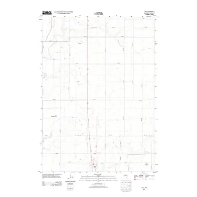
2013 Map of Lyle
USGS Topo · Published 2013About this map
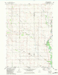
Lyle and the surrounding township in Mower County appear as a grid of rural section roads and waterways in this southern Minnesota landscape. The primary north-south corridor follows Us-218, connecting the border town of Lyle with the settlement of Varco to the north. Waterways like the Cedar River, Rose Cr, and Otter Cr cut diagonally through the agricultural sections, dictating the placement of leisure sites like the River Bend Campground. For genealogists and local historians, the map identifies specific burial grounds including Rose Creek Cem and Sixmile Grove Cem, both situated near the small creeks that drain this prairie region. The layout of the town of Lyle itself shows a concentrated street grid near the Po, marking the community's role as a local hub near the Iowa state line.
Find a feature on this map
42 named features on this map. Tap any name to fly to it.
Don’t see what you’re looking for? This feature index may not catch every label — zoom into the map to look around manually.
Map Details
Editions of this 2013 Lyle Map
This is the sole edition of this map. No revisions or reprints were ever made.
Other maps of this area

1954 · Hayward
USGS Topo · 1:62,500

1954 · Austin
USGS Topo · 1:62,500

1954 · Mason City
USGS Topo · 1:250,000

1957 · Mason City
USGS Topo · 1:250,000

1958 · Mason City
USGS Topo · 1:250,000

1972 · St. Ansgar
USGS Topo · 1:24,000
1972 · Stacyville
USGS Topo · 1:24,000
1972 · Carpenter
USGS Topo · 1:24,000
1982 · Austin East
USGS Topo · 1:24,000
1982 · London
USGS Topo · 1:24,000